
Land Topographical Surveys in Cambridgeshire
Accurate Topographical Site Data
Get a Free Quote From Us Today!
We aim to get back to you in 24 hours.
At Land Topographical Surveys, we specialise in providing detailed and accurate land surveys across Cambridgeshire. Our surveys are essential for architects, engineers and developers, offering precise measurements and data for planning and construction projects.
We use advanced surveying equipment to capture topographical data, ensuring all relevant features of a site are accurately recorded. Covering Cambridgeshire and the surrounding CB postcode area, we are committed to delivering reliable survey solutions.
Contact us today for a professional survey service.
What Is a Land Topographical Survey?
A land topographical survey is a detailed analysis of a site’s physical features and topography. At Land Topographical Surveys, we capture essential data such as ground contours, elevations, and structures in Cambridgeshire.
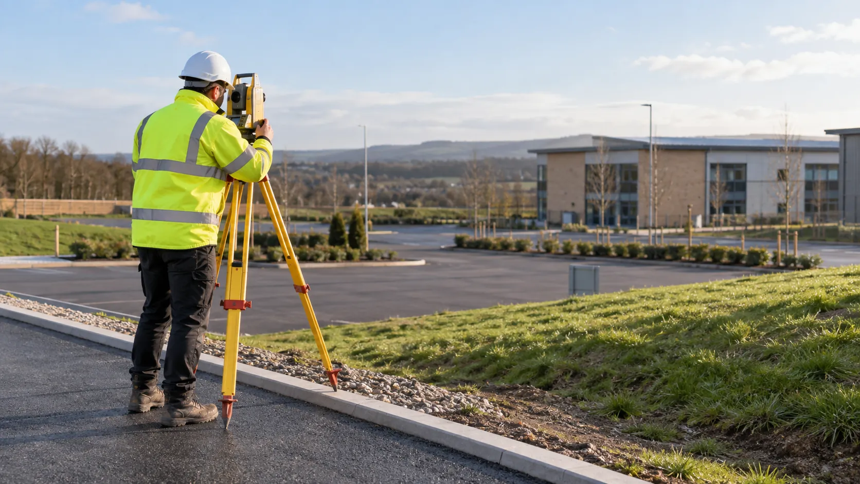
Using specialised equipment like total stations and GPS receivers, we measure precise coordinates and levels, mapping natural features like trees and rivers as well as man-made structures such as roads and utility lines.
This information aids in designing projects and constructing buildings by offering a view of the land’s conditions. Our surveys help ensure that every aspect of a site is understood before development begins, minimising potential issues related to drainage, land grading, and structural stability.
We adhere to industry standards set by organisations such as the Royal Institution of Chartered Surveyors (RICS) to deliver dependable results. Contact us to discuss your survey requirements and how we can assist your project.
How Much Does a Land Topographical Survey Cost in Cambridgeshire?
A land topographical survey typically costs between £300 and £1,500 in Cambridgeshire. The exact cost depends on factors such as the size of the site, complexity, and specific requirements.
For instance, a site with varied elevations, numerous boundaries, or unique terrain features can influence costs. Larger areas or sites with dense features may incur higher costs due to the detailed data collection needed using equipment like theodolites and GPS receivers.
Additionally, if the survey requires CAD drawings or needs to adhere to specific accuracy standards such as ISO 17123, this might also affect the pricing. We provide precise pricing upon consultation, ensuring no hidden fees.
Understanding your project timeline and urgency can also impact the overall cost. For a detailed quote that fits your project needs, contact us to discuss your site’s specifics.
Get a Free No Obligation Quotation Today
Why Choose the company Land Topographical Surveys for Land Surveys in Cambridgeshire?
We at Land Topographical Surveys offer reliable, comprehensive surveying solutions across Cambridgeshire. Our experienced team uses state-of-the-art equipment, including total stations and GPS units, to gather precise data.
We also employ digital levelling tools to obtain accurate elevation measurements and 3D laser scanners for detailed topographical mapping. Adhering to industry standards such as BS 5606:1990, we ensure that our surveys meet the highest accuracy and specification requirements.
Our services cater to a diverse range of clients, including architects, engineers, and property developers, providing essential data for planning and construction projects. Additionally, we offer boundary surveys to resolve property line disputes and ensure compliance with local regulations.
Choose us for swift and professional service with clear communication throughout, and let our expertise guide your project to success.
What Are the Benefits of Land Topographical Surveys in Cambridgeshire?
Land topographical surveys offer numerous benefits in Cambridgeshire. Conducting these surveys allows us to ensure that every potential issue is identified early, preventing costly construction errors and delays.
Our surveys facilitate precise planning and design by providing invaluable data.
- Accurate mapping of site features gives a detailed understanding of existing structures, boundaries, and utilities, ensuring regulatory compliance.
- Comprehensive elevation data assists in drainage and flood risk assessments, helping to meet environmental guidelines.
- Identification of potential natural hazards, such as landslides or subsidence, protects both infrastructure and safety.
- Detailed reports for effective planning include measurements adhering to British Standard BS 5964, aiding architects and engineers in informed decision-making.
Through meticulous analysis, we support diverse clients, from residential developers to large-scale commercial projects. Get in touch to learn more.
What Does a Land Topographical Survey Cover?
Our land topographical surveys encompass a broad range of elements to provide a thorough site analysis. We use specialised tools such as Total Stations and GPS technology to accurately measure natural features like trees and contours, as well as artificial structures including buildings, roads and utility lines.
We meticulously detail elevation changes and drainage patterns, identifying potential flood risks that could impact future developments.
Our surveys also adhere to industry standards such as the RICS specification for accuracy and detail, providing reliable data that assists architects and planners in designing projects that are both feasible and compliant. For properties in conservation areas or with heritage concerns, we conduct specific analysis to preserve essential characteristics.
This detailed overview supports informed decision-making for all construction and planning processes. Contact us to discuss your project’s requirements.
Request a free quote
Frequently Asked Questions
How Long Does a Land Topographical Survey Take?
Most land topographical surveys in Cambridgeshire are completed within two to three days, depending on site complexity and size. Larger or more complex sites may take longer.
Can a Land Topographical Survey Help with Planning Permissions?
Yes, a land topographical survey can provide crucial information required for planning permission applications, supporting various project requirements in Cambridgeshire.
Do You Provide Aftercare Following the Survey?
We offer ongoing support following a survey to aid with any queries or requirements that arise. Our team is available to provide additional assistance as needed.
Are Your Surveys Suitable for Large-Scale Developments?
Our surveys are suitable for both small and large-scale developments. We have the capability to handle extensive areas and provide detailed reports.
What Areas Do You Cover?
We conduct surveys throughout Cambridgeshire and the wider CB postcode area, ensuring coverage for various projects.
Get a Free Quote for Land Topographical Surveys in Cambridgeshire
Contact us today to arrange your land topographical survey in Cambridgeshire. Our team is here to provide a free quote and discuss your specific requirements.
speak with our team today
What People are Saying About Us
★★★★★
“The Land Topographical Surveys crew were friendly, helpful and no trouble at all. Would happily use them again for any site.”
Fiona Barker
East of England
★★★★★
“We needed an accurate levels survey for our extension plans. Land Topographical Surveys delivered it quickly, so our architect could move on to the planning stage.”
Chloe Holloway
East of England
★★★★★
“Delighted with our levels survey from Land Topographical Surveys. A friendly and professional site visit.”
Naomi Brennan
East of England
★★★★★
“I cannot thank Land Topographical Surveys enough. I felt completely at ease throughout and would recommend them to absolutely anyone!”
James Davies
East of England
Our Locations
Looking for our services in another area in Cambridgeshire? We are proud to work nationally across the UK, allowing us to ensure we can provide our specialist Land Topographical Surveys services to you.
For a full list of locations we cover in Cambridgeshire, see below.